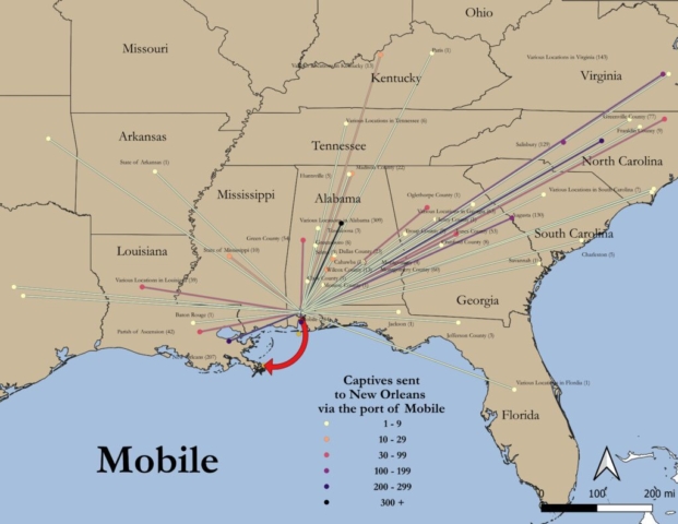
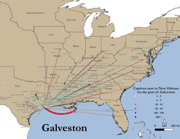
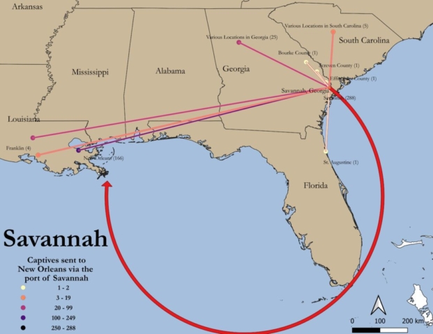
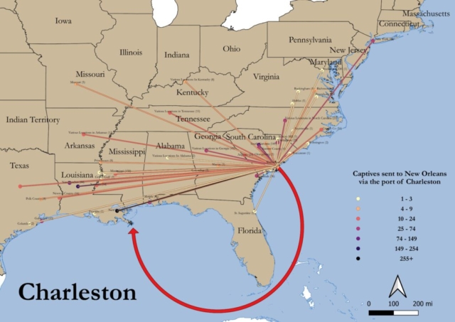
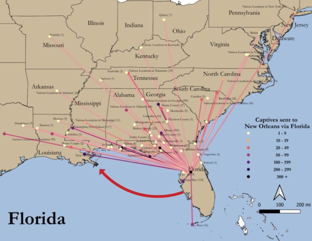
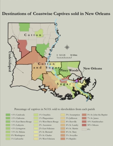
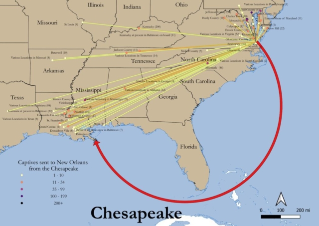
Oceans of Kinfolk: The Coastwise Traffic of Enslaved People to New Orleans, 1820-1860 by Dr. Jennie Williams Ph.D.
Project Parameters: Providing GIS and research assistance to doctoral candidate at Johns Hopkins Univeristy researching the coastwise traffic of enslaved people to New Orleans between 1820 and 1860. Dr. Jennie Williams Ph.D. generously gave her permission for this project to be included.
The full project is available here Oceans of Kinfolk at the John Hopkins University Libraries Scholarship page
The full database is also now available at SlaveVoyages.org – Oceans of Kinfolks Database at SlaveVoyages.org
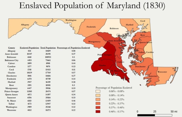
What I did: I assisted the candiate with GIS and research and then developed and created maps using QGIS for inclusion in her disseration. Geolocation, cartography and assisting with research and graphics were my main contributions to the project. I am pleased that the disseration was accepted and the maps were referenced as a outstanding addition to the project.
Outcomes:
- Describe, select and apply the functional and analytical capabilities of GIS
- Organize and visualize spatial data in QGIS
- Working with a client to customize maps for publication
- Experience working with an eduational researcher and reseach project


